For directions, google "Lunt Hollow, Utah" which will take you right to the trailhead. It is close to Nephi, Utah. I DO NOT RECOMMEND coming over the Nebo Loop from Payson. Much easier and faster to come from Nephi.

This is our track on our first ride on Sept. 10. We couldn't spot the trail over to McCune Canyon by the Ponderosa Campground, so we just followed the well traveled trail. It took us right up Salt Spring Creek. At the time I didn't know which side of Mahogany Hill we were on or even which trail. We reached Maple Spring and saw a road. I thought it was the road with the "lollipop" turn around, so headed east. We followed cattle trails and basically got stopped by brush and deadfall and steep slopes. "I don't think we're on the right trail." Our only option was to go back the way we came. I didn't fully realize our mistake until I looked at the track.
Here are some shots of the Salt Springs.
The photo below shows where the salt spring emerges.
The photo below shows what we call "Dead Cow Pond." You can probably guess the reason why.
This shows a critical junction. We saw both trails and chose the one to the left because I thought we might be on the right side of Mahogany Hill. It turns out we were no where near the hill and should have take the right fork. The left leads up a ridge to Maple Spring. We took the right fork on our October 3rd ride.
Heading to Maple Spring.
Just a small sample of the bushwhacking on our Sept 10 adventure.
Heading back down from Maple Spring.
Salt Spring on the way down, Sept. 10.
Old cabin up about 1/2 mile on the trail. I understand there used to be a salt mine nearby.
The yellow arrow shows the trail that connects over to McCune Canyon and that route up. We missed it twice.
Here is the spot marked on a map.
Crossing of Salt Creek. Good place to water horses.
Our 2nd trip was Sept. 22. We found the trail over the ridge to McCune in a round-about way. It's very pretty and goes through some ponderosas and up a meadow.
We made it up the correct canyon. I had figured the turn on the loop was 1.8 miles in. I hadn't figured our extra mileage looking for the trail. So, when 1.8 miles came up, there was a turn off, but it wasn't the right one. We spent some time wandering through the forest, then went back out.
The ride up the canyon was very pretty. We got to another turn off and chose to turn south. I thought it might be on the west of Mahogany Hill. I really didn't know where we were. It ended up being the east side of Mahogany Hill. I hoped we could find the road and ride to Maple Spring. The blue track is on Sept. 22. The pink track is the one we intended, but now that I know more about that trail, it's a good thing we didn't attempt it. As it turned out, we ended up going down Salt Spring Creek and I didn't recognize until we reached "Dead Cow Pond." "Now, I know exactly where we are!"
On October 3, we tried again. This time I intended to ride UP Salt Spring again, take the connector trail over to the "lollipop" road and proceed up the west side of Mahogany Hill. I knew it was very steep according to the map, so I intended an uphill rather than downhill journey. Here is our Oct. 3 track. We went up as far as we felt safe. We ran into an extremely steep and rocky portion that I just didn't feel confident in doing. It probably got worse and I never want to go up a place where I can't get down. A hiker could handle it, (maybe, but not me).
Heading up to the west side of Mahogany Hill.
This is the place that stopped us. Doesn't look that bad.
After going back down the road, we knew where the springs were and headed there.
Maple Springs watering trough.
And back to the trailer. Here's the parking lot. Lots of room and a rest room, too.
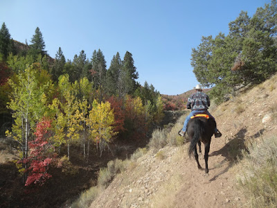
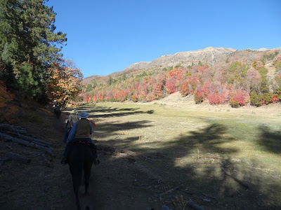
I am not crossing this one off our list. It had gorgeous fall colors on Oct. 3.
As it happens, we rode this again on October 10 with a group from the Backcountry Horsemen of Central Utah.
This is our track for October 10.
The following are some photos from that ride.


No comments:
Post a Comment