Thursday, September 24, 2020

Huntington Canyon~Candland Mountain


We had to at least try this trail because it is only a 38 minute drive from home.  The photos on the internet looked great and the trailhead showed signs of heavy horse usage.  It WAS a beautiful day for a ride.  Not much autumn color except for some aspen. 
 However, we're crossing this trail off our list.  Too much climbing and then you have come down what steepness you go up.  There were parts on the trail that had me totally stressed out...that is the trail was narrow and on the side of a steep hill with banks caving and rocks all on a downhill.  No photos of this, not that any could do it justice.   
Glad we tried it, but won't be going back.

(UPDATE!  August 5, 2021, We drove by the trailhead and I was astonished at the decimation of the forest!  Apparently logging prevails!  No more trail on this lower part, but only two logging roads.  This is sad, because this part was the prettiest forest.  Oh well, maybe they will reconstruct the trail with some switchbacks.)

August 5, 2021

August 5, 2021

Photo taken from a website from several years back.


The following shows the parking area just past Cleveland Reservoir and just before Electric Lake.

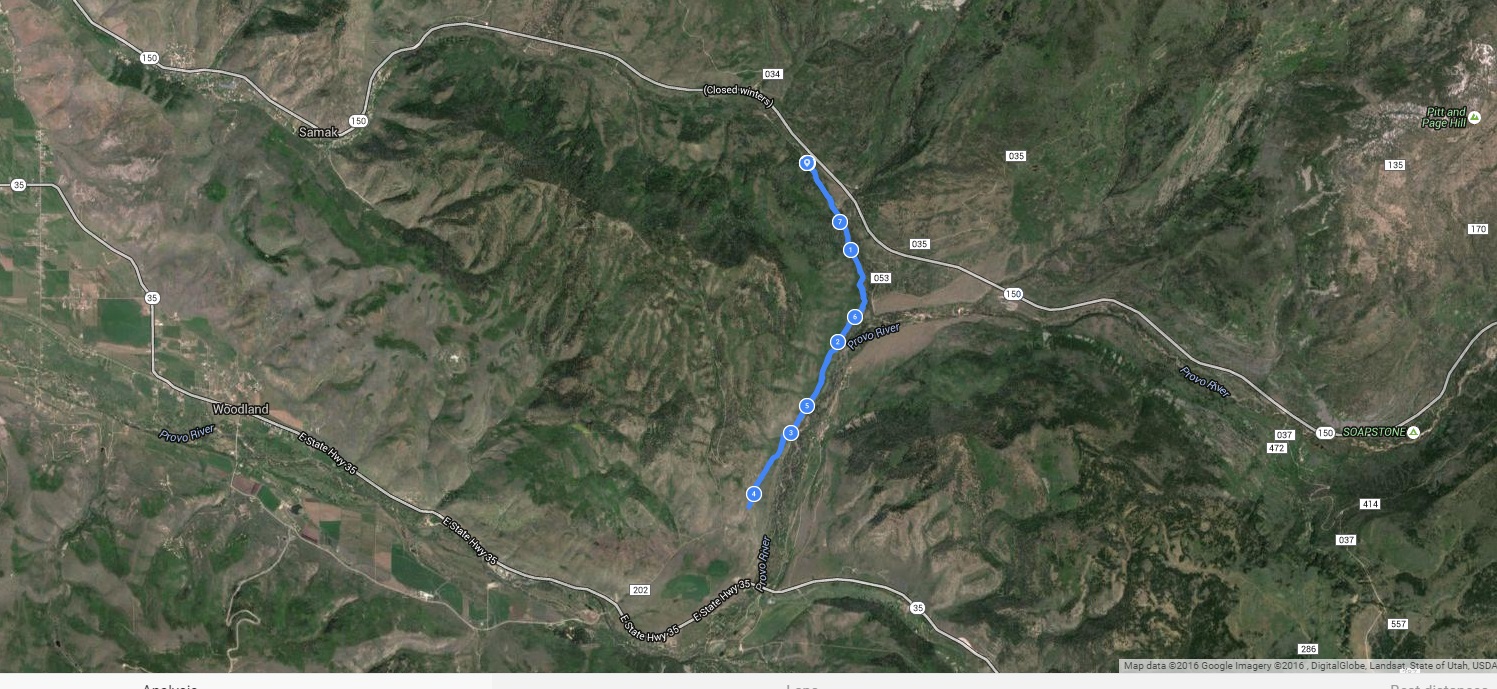
This is our track. We got in slightly more than 2.7 miles out of the total 6 mile trail. Elevation was 8,652' to 9,954'. Ascent/Descent=1,290'  Trail conditions=90% dust/dirt; 10% Rocky. (Glad it wasn't rockier or it really would have been miserable.)


Starts out in lovely forest, but steep.


There is one section where the trail follows an old pipeline.  Wish the whole trail was that nice.


Reached the top of one ridge.


There were some spectacular views.


Here we are approaching the "Hellish Hillside."


Nice view of Cleveland Reservoir.  We could also see Miller Flat Reservoir.


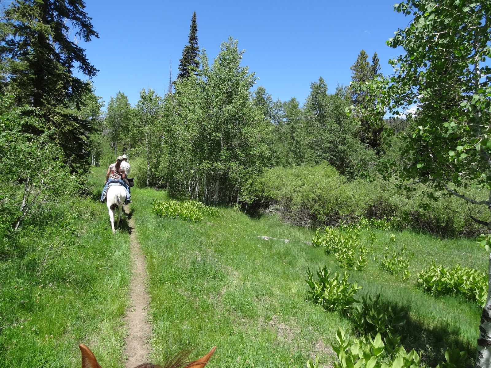
Occasionally, through some lovely aspen.


It was shortly after this next photo that we came to a heavily forested area that was super steep to ascend.  We got up it, but declined on going any further.  It was just too steep and that next ridge looked too high.     

Next photos are once we were past the steep descent.  Looking at these, it looks like a great ride!  We did hear alot of elk bugling.


That's Electric Lake in the far distance.


The next picture is one from the internet that made it look wonderful.


Thursday, September 17, 2020

Huntington Canyon~Left Fork


We only rode about 1 3/4 mile from the upper trailhead.  Didn't even get to the canyon.  It LOOKED like a great ride with lots of evidence of horse traffic.  I couldn't find too much online about it.  I found a few photos afterward and am glad we didn't try to ride too far into the canyon. The trailhead is on the Miller Flat road which is between Huntington and Cleveland Reservoirs.  It's about 2.5 miles of driving on gravel/dirt road from the turn off on Hwy 31.   The photo above was on a little side trail.  This is the Left Fork and there is a trail crossing the creek here, but we didn't dare try it.  Looking at the map afterward, it does connect to the main Left Fork trail.

The pink arrow shows the turn off.  The yellow arrow shows the trailhead.  There is room for two MAYBE three outfits.  If you decide to try this one, get there early for a good parking spot. There is a rest room.


This is the sign at the trailhead.  Should have been a clue when it said "No Bicycles."  It would have been super difficult to even try to take a bike.


Started out looking promising.

Pretty view into "Staker Canyon", not even to the Left Fork yet.

Really beautiful view here.  No photos of the dusty trail with some drop offs and rocks.  I'd hate to try it when wet.

Again, really pretty in Staker Canyon.

Crossing Staker Creek bridge...


Heading up the hillside toward the Left Fork...

Nice view of the Left Fork.  The trail varies from rocky and somewhat steep to soft and dusty.


Coming up on a bridge over the Left Fork.


This is an internet photo close up of the bridge.


Some really interesting scenery...after the bridge crossing.

Then, a nice view of a small waterfall on Miller Flat Creek.

We rode until we got to this view.  Can't see it, but the trail goes around a steep cliff with a narrow trail. We hadn't even reached the turn off to Scad Valley yet, but didn't want to deal with more riding on steep drop off trails.

 Most riders and horses would have no problem, but I have been a little nervous about drop offs ever since the trail gave way and my horse and I fell down an embankment (that was on a trail in Bountiful).  

I found the following photo on the internet of a part of the trail.  This makes me really nervous and wouldn't care to ride this one.  Hike...maybe, but not ride.

This photo was on our way back...a beaver pond on Staker Creek.

This shows some of the rocky trail.  This part wasn't a problem on our way back because it was uphill, but Mozzy had a little trouble negotiating it downhill.


This is the Endomondo track of our ride.  3.5 miles total.


These two photos I took of the bottom trailhead, which we "reconned" before riding.  


This is the map at the trailhead.


All said and done, we probably won't be doing this trail again, but are glad we at least tried it once.  Realize we are super conservative on trails.  So, you are welcome to give it a try if you're in the neighborhood.


Sunday, June 19, 2016

Pine Valley, Shingle Creek, Utah


Reasonably easy trail in the western Uinta Mountains, about 6 miles east of Kamas. Compared to other trails in the area, it's free of snow fairly early in the season.  In June, some deep mud pockets can persist. It is recommended for Spring and Fall riding when the higher elevations are inaccessible due to snow. Once you leave the Beaver Creek portion for the Pine Valley Trail, it gets more open and rocky.  There are other trails in the area.  I just haven't ridden them yet.


A string of beaver ponds within the first half mile of trail. Best parts of the trail here! This is actually called the "Beaver Creek" trail. Beaver Creek joins Shingle Creek further south.

Directions from Kamas, Utah

Close up of the parking area at the trailhead.  There is room for about 3 trailer rigs if not too many cars. There is a rest room. 
7.65 miles up to ridge and back.  Min Altitude=7,326'; Max Altitude=7,579'.  Ascent/Descent=633'; Trail conditions=75% dirt, 3% mud, the rest is gravelly and rocky.  A barefoot horse in reasonably good condition can handle it fine. Tender footed horses need boots or shoes for the rocky parts.


Take this turn off up to the Pine Valley trail.


Some muddy spots.

A couple of nice meadows and open spots.

About 2.7 miles in there is a gate.  On the other side are cattle.

Gorgeous views of Pine Valley.


Typical of the trail up on the ridge.

The "Top".  There is where I would recommend turning around.  The trail goes further down to State Highway 35, taking about another 2 miles.  Not sure what that part is like.  My guess is dry and open.

Again, typical of the rocky parts of the trail.

Nice views back towards the Uintas and Haystack Mountain in the far distance.


Typical of the dirt parts of the trail.


Beaver ponds on the way back to the trail head.