|
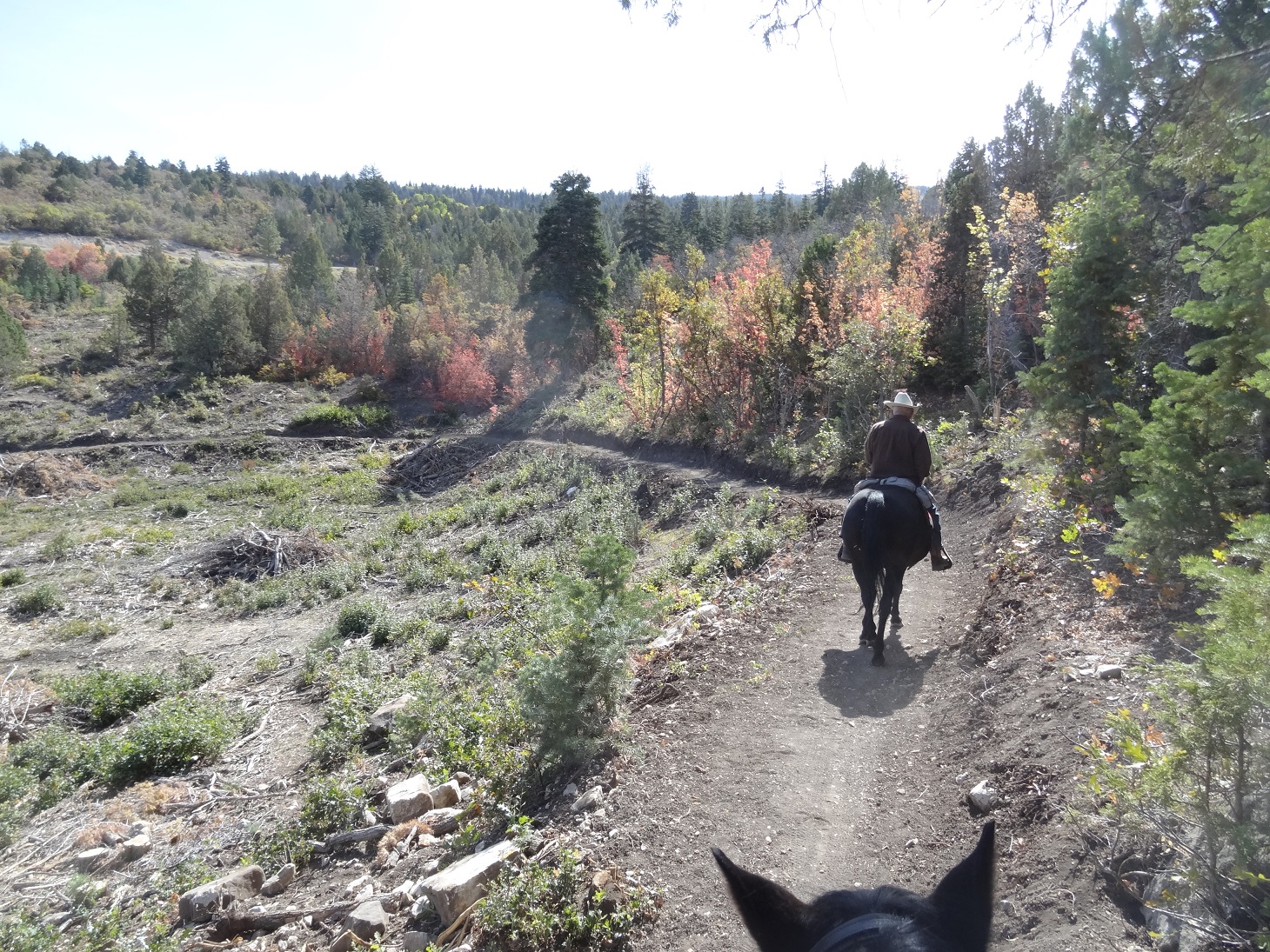
| Nov. 4, 2025, trail still dry and beautiful |
(formerly referred to as Pig Pen Spring) This is the 4th post on Ephraim Canyon trails. Please refer to the previous posts before venturing here. We rode this trail on June 22, 2022 because we had been informed the "cutting" was finished and it was a probable loop from the Ponderosa Pull Out. We think we saw the remnants of a spring, but appears to be dried up now. Apparently, it was used to fill radiators and cool off vehicles on their way to the Great Basin Research Station in the 1930s and 1940s. Someone else told us that pigs were raised right by the spring.
This is a beautiful loop ride. No water features, but meadows, wildflowers, evergreens, juniper, scrub oak, maples, aspen and VIEWS! I am fairly sure we were the first ones to ride on this trail. No tracks except for the trail making machinery. (Update as of July 28, 2022. The trail is now completely cut to the Ponderosa Pull Out. And trail maintenance crews have smoothed out the ruts and roots and are adding gravel in many spots. )
 |
| The Blue line shows where the trail begins across the road from the Ponderosa Pull Out. |
 |
| Trail going up from the Ponderosa Pull out. |
We parked and rode the Stop Watch trail up to Willow Creek Road TH. Then across the road in about 30 yards where the new trail begins.
.JPG) |
| Track for the day. 4.3 miles which included the side trail up past the spring. .3 mile up the road is the end of the Mirkwood trail. Trail conditions: 95% soft dirt/woodland twigs, 5% slightly rocky. Total ascent/descent=759 ft. Highest elevation=7,923' |
 |
| Map courtesy of Sanpete Mountain Biking Community. The green shows existing trails. Yellow is the newly cut "Templar". Orange is the Keebler Trail going from the Mirkwood Trail to the Lake Hill turnoff road. Purple is the newly cut connector to the Pioneer Trail. |
.JPG) |
| This is a track from June 27, 2022. We were able to ride a beautiful loop by starting clockwise at the Ponderosa Pull Out. Riding .3 mile on the side of the road to the top of the Mirkwood Trail and finishing up on the Scandinavian and Stop Watch Trails. 5.9 miles. Elevation: 7,419' to 8,002'. 95% dirt, 5% slightly rocky. |
 |
| June 4, 2024. Death Camas was ALL over the lower parts of this trail |
I have never seen so much Death Camas at one time! Beware!
 |
June 4, 2024. This log was over the trail, but our horses were able to get over it.
|
.JPG) |
| Looking at the Willow Creek Rd parking area turn off from the "Templar" trail. |
.JPG) |
| We can see the trailer. |
.JPG) |
| Downfall that stopped us from exploring the cutoff to the Pioneer Trail on June 27, 2022 |
.JPG) |
| The cutoff trail is heavily forested...beautiful. |
.JPG) |
| This is coming up on the Templar trail FROM Ponderosa. The yellow arrow shows the intersection. Keep to the left for the upper Templar trail and to the right to get back to the Willow Creek Road TH. |
.JPG) |
| This shows the road which connects the upper Templar to the Mirkwood. About 1/4 mile of riding along the roadside. |
.JPG) |
| Sept. 1, 2022 |
.JPG) |
| Sept. 1, 2022 |
 |
| "Top" of the Templar Trail--no parking or pull out. |
.jpg) |
| Sept. 1, 2022 |
.jpg) |
| Trail to Willow Creek Rd from the main Templar trail. |
.JPG) |
| October 7, 2022 |
.JPG) |
| October 7, 2022 |
 |
June 4, 2024, just coming upon the Templar from the Willow Creek connector.
Nov. 4, 2025, just coming upon the Templar from the Willow Creek connector showing the new wood carving statue of a"Knight Templar."
|
 |
| September 5, 2024, A series of about 5 bike "jumps" are on the upper Templar. Most of them bypass the regular trail. This is one. |
.jpg) |
October 7, 2022
The following pictures are courtesy of Sanpete Mountain biking showing some "jumps" under construction (as of September 12, 2024. The trail is engineered so hoof and foot traffic can avoid them.)

|
.JPG) A short, but nice trail a little further up Ephraim Canyon. Probably best in July through September. We rode on August 4 and there were still a few wildflowers left. This IS a biking trail that is probably used quite a bit on the weekends. We were there on a weekday and didn't see anyone else but a woman hiking with two dogs at the intersection of FS road and the trail. I like the deep forest of evergreen and aspen. I like the small water feature that provides enough for the animals thirst. I like the soft, dirt trail and the peace and quiet. I do like the nice place to park, even though it catches the dust from passing vehicles. I don't like the washboard, dusty road for 1.2 miles.
A short, but nice trail a little further up Ephraim Canyon. Probably best in July through September. We rode on August 4 and there were still a few wildflowers left. This IS a biking trail that is probably used quite a bit on the weekends. We were there on a weekday and didn't see anyone else but a woman hiking with two dogs at the intersection of FS road and the trail. I like the deep forest of evergreen and aspen. I like the small water feature that provides enough for the animals thirst. I like the soft, dirt trail and the peace and quiet. I do like the nice place to park, even though it catches the dust from passing vehicles. I don't like the washboard, dusty road for 1.2 miles.
.JPG)
.JPG)
.JPG)


.JPG)
.JPG)
.JPG)
.JPG)
.JPG)
.JPG)
.JPG)
.JPG)
.jpg)
.JPG)
.JPG)
.JPG)


.JPG)
.JPG)


.JPG)
.JPG)


.JPG)


.JPG)

.JPG)


.JPG)
.JPG)
.JPG)
.JPG)
.JPG)
.JPG)
.JPG)
.JPG)
.JPG)
.JPG)
.JPG)
.JPG)
.JPG)
.JPG)
.JPG)

.jpg)
.jpg)
.JPG)
.JPG)


.jpg)