Tuesday, September 29, 2020

Ephraim Canyon--Scandinavian~Mirkwood

(updated September 22, 2025)
I have split the Ephraim Canyon trails into now 7 different posts.  Please read them all before venturing there.  Here is a link to a recent video. (I had to turn the sound off.)    https://www.youtube.com/watch?v=BIn2_Ick-9I

The Mirkwood and Scandinavian are fairly new (2020-21) but are definitely favorites during the summer season.


(Remember to click on any photo to open enlarged images.)

Scandinavian Trail, Sept. 22, 2025


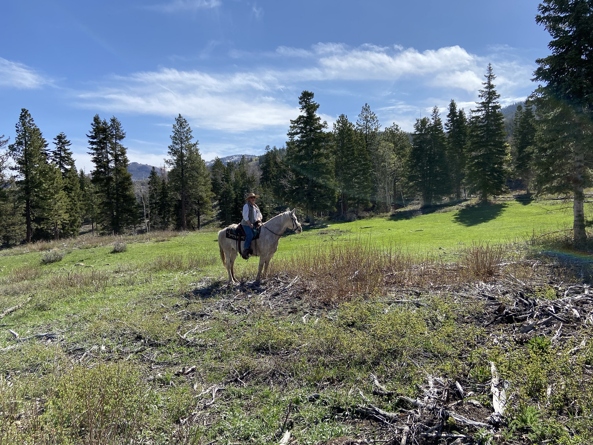
Scandinavian Trail, May 16, 2022

Yay!!!! as of July, 2023, A GATE has been inserted to make this obstacle passable for horses and humans at about .2 miles in on the Scandinavian Trail.  Thank you to whoever did this.


Thank you to whoever put in this gate .4 miles in on the Mirkwood Trail!!  


As of Sept. 2025, wire has been strung across the previous "get around".  So, we had to go through the gate.


Logging area, Mirkwood Trail, August 25, 2023

Loop done on August 25, 2023. Included the Templar, Mirkwood, Scandinavian and Stop Watch trails. Total mileage=5.9; Downed timber=1 spot; Gates=2; Boggy spots=2;

    On October 8, 2020 we parked at Ponderosa TH and rode up to Willow Creek Road TH.   From there we went on a trail recon and found a lovely trail that sort of paralleled the Willow Creek forest service road (0051).  It begins at the intersection of FS road 0051 and the canyon road.  See the photo below☺. I found out later it has a name:  Scandinavian Trail.  https://www.trailforks.com/trails/scandinavian/

Here is a photo (2020) of the entry with the smiley face paper plate. Since this photo was taken, this entrance has been revamped and no more smiley face. 😂, But an actual trail sign.
Same spot as above 2.5 years later.


There are a few new trail signs.


Here is our track for that day, October 8, 2020--6.75 miles round trip. 85% soft dirt, 15% slightly gravelly or rocky. Altitude=7,388' to 7,848'.

The above ride was stellar...soft trails, vibrant colors, forests of maples, evergreens, aspens.  Almost perfect.  Just missing a water feature.   It included Stop Watch, all of Scandinavian and even rode a portion of a trail we found out is named "Patriot."  I had originally thought it was "Maple Syrup", but that trail has been closed, re-routed.  Too bad, somehow I like the name Maple Syrup better

 The following photos are from our October 8, 2020 ride of the Scandinavian Trail:


This is approximately the same spot as the photo above on the "beginning" of the Scandinavian trail except 5 years later.  Again, note the bush growth.


NEXT UPDATE--OCTOBER 14, 2020 ride included most of what is called "Mirkwood" Trail.  This trail was just completed in 2020 and is amazing in my opinion.  Why?  Soft, wide dirt trail that has many ups and downs and winds through forest of aspen, evergreen, maples, willows and has expansive views of the Ephraim area.  We will be going back here often.  Only thing missing is that water feature.

The following photos are on the Mirkwood Trail:


This is the same spot as the photo above except 4 years later. (Sept. 11, 2025) Note the growth of the scrub oak back.


This was our track for Oct. 14, 2020.  About 7 miles. We parked at Ponderosa.  It included part of the Stop Watch Trail, most of the Scandinavian and Mirkwood trails.  Elevation=7,382' to 8,068'.  Trail conditions=90% soft dirt, 10% gravelly or somewhat rocky.


   For more information run a search for "Mirkwood" trail in Ephraim Canyon.


(Update:  We went on Saturday, May 15, 2021 and only saw one other person on a trail--he was riding a bike on the lower trail. There is a small stream across the Scandinavian for horses and dogs to drink, but it often disappears later in the season.)

A transient "pond" only there in the Spring in most years.

As of August 25, 2023, the pond is still there.


Another pond usually only there in the Spring.

Things starting to green up. May, 2021

Almost the same spot as above on September 22, 2025 showing the amount of growth of the bushes.


This is the intersection of the Scandinavian and Mirkwood Trails, 2021

This is the same intersection as above, but in September of 2025.  Note the scrub oak near the trail has been sprayed.


There ARE numerous places along the Willow Creek Road to disperse camp.   


Scandinavian Trail on June 24, 2021


Mirkwood on July 7, 2022

Mirkwood on July 12, 2022


Mirkwood on July 28, 2022


Mirkwood Logging , June 11, 2024 

June 11, 2024 "Warnings" on the Mirkwood.  We didn't see any logging action. As of Sept., 2025, the logging signs have been taken down.


Scandinavian, June 11, 2024

Mirkwood, June 19, 2024


Scandinavian Trail, Sept. 11, 2025


Thursday, September 24, 2020

Huntington Canyon~Candland Mountain


We had to at least try this trail because it is only a 38 minute drive from home.  The photos on the internet looked great and the trailhead showed signs of heavy horse usage.  It WAS a beautiful day for a ride.  Not much autumn color except for some aspen. 
 However, we're crossing this trail off our list.  Too much climbing and then you have come down what steepness you go up.  There were parts on the trail that had me totally stressed out...that is the trail was narrow and on the side of a steep hill with banks caving and rocks all on a downhill.  No photos of this, not that any could do it justice.   
Glad we tried it, but won't be going back.

(UPDATE!  August 5, 2021, We drove by the trailhead and I was astonished at the decimation of the forest!  Apparently logging prevails!  No more trail on this lower part, but only two logging roads.  This is sad, because this part was the prettiest forest.  Oh well, maybe they will reconstruct the trail with some switchbacks.)

August 5, 2021

August 5, 2021

Photo taken from a website from several years back.


The following shows the parking area just past Cleveland Reservoir and just before Electric Lake.

This is our track. We got in slightly more than 2.7 miles out of the total 6 mile trail. Elevation was 8,652' to 9,954'. Ascent/Descent=1,290'  Trail conditions=90% dust/dirt; 10% Rocky. (Glad it wasn't rockier or it really would have been miserable.)


Starts out in lovely forest, but steep.


There is one section where the trail follows an old pipeline.  Wish the whole trail was that nice.


Reached the top of one ridge.


There were some spectacular views.


Here we are approaching the "Hellish Hillside."


Nice view of Cleveland Reservoir.  We could also see Miller Flat Reservoir.


Occasionally, through some lovely aspen.


It was shortly after this next photo that we came to a heavily forested area that was super steep to ascend.  We got up it, but declined on going any further.  It was just too steep and that next ridge looked too high.     

Next photos are once we were past the steep descent.  Looking at these, it looks like a great ride!  We did hear alot of elk bugling.


That's Electric Lake in the far distance.


The next picture is one from the internet that made it look wonderful.


Thursday, September 17, 2020

Huntington Canyon~Left Fork


We only rode about 1 3/4 mile from the upper trailhead.  Didn't even get to the canyon.  It LOOKED like a great ride with lots of evidence of horse traffic.  I couldn't find too much online about it.  I found a few photos afterward and am glad we didn't try to ride too far into the canyon. The trailhead is on the Miller Flat road which is between Huntington and Cleveland Reservoirs.  It's about 2.5 miles of driving on gravel/dirt road from the turn off on Hwy 31.   The photo above was on a little side trail.  This is the Left Fork and there is a trail crossing the creek here, but we didn't dare try it.  Looking at the map afterward, it does connect to the main Left Fork trail.

The pink arrow shows the turn off.  The yellow arrow shows the trailhead.  There is room for two MAYBE three outfits.  If you decide to try this one, get there early for a good parking spot. There is a rest room.


This is the sign at the trailhead.  Should have been a clue when it said "No Bicycles."  It would have been super difficult to even try to take a bike.


Started out looking promising.

Pretty view into "Staker Canyon", not even to the Left Fork yet.

Really beautiful view here.  No photos of the dusty trail with some drop offs and rocks.  I'd hate to try it when wet.

Again, really pretty in Staker Canyon.

Crossing Staker Creek bridge...


Heading up the hillside toward the Left Fork...

Nice view of the Left Fork.  The trail varies from rocky and somewhat steep to soft and dusty.


Coming up on a bridge over the Left Fork.


This is an internet photo close up of the bridge.


Some really interesting scenery...after the bridge crossing.

Then, a nice view of a small waterfall on Miller Flat Creek.

We rode until we got to this view.  Can't see it, but the trail goes around a steep cliff with a narrow trail. We hadn't even reached the turn off to Scad Valley yet, but didn't want to deal with more riding on steep drop off trails.

 Most riders and horses would have no problem, but I have been a little nervous about drop offs ever since the trail gave way and my horse and I fell down an embankment (that was on a trail in Bountiful).  

I found the following photo on the internet of a part of the trail.  This makes me really nervous and wouldn't care to ride this one.  Hike...maybe, but not ride.

This photo was on our way back...a beaver pond on Staker Creek.

This shows some of the rocky trail.  This part wasn't a problem on our way back because it was uphill, but Mozzy had a little trouble negotiating it downhill.


This is the Endomondo track of our ride.  3.5 miles total.


These two photos I took of the bottom trailhead, which we "reconned" before riding.  


This is the map at the trailhead.


All said and done, we probably won't be doing this trail again, but are glad we at least tried it once.  Realize we are super conservative on trails.  So, you are welcome to give it a try if you're in the neighborhood.