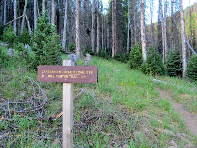
I have split the Ephraim Canyon trails into now 7 different posts. Please read them all before venturing there. Here is a link to a recent video. (I had to turn the sound off.) https://www.youtube.com/watch?v=BIn2_Ick-9I
The Mirkwood and Scandinavian are fairly new (2020-21) but are definitely favorites during the summer season.
Here is a good overview of the trail system: http://www.utahmountainbiking.com/trails/ephraim-canyon.htm?fbclid=IwAR37zkiiH2kL_LBdM3GCRfJfqYL_51tvuO9cA1ngpIiDZNhHfdFL5Gz3ENI
And here is another good site: https://www.google.com/maps/d/u/0/viewer?mid=1p3r3Yz3gtqybACufeLvwVtiQCaL9bIBg&shorturl=1&ll=39.33094206778154%2C-111.49722740998462&z=15
(Remember to click on any photo to open enlarged images.)
.jpg) |
| Scandinavian Trail, May 16, 2022 |
 |
| Yay!!!! as of July, 2023, A GATE has been inserted to make this obstacle passable for horses and humans at about .2 miles in on the Scandinavian Trail. Thank you to whoever did this. |
 |
| Thank you to whoever put in this gate .4 miles in on the Mirkwood Trail!! As of Sept. 2025, wire has been strung across the previous "get around". So, we had to go through the gate. |
 |
| Logging area, Mirkwood Trail, August 25, 2023 |
 |
| Loop done on August 25, 2023. Included the Templar, Mirkwood, Scandinavian and Stop Watch trails. Total mileage=5.9; Downed timber=1 spot; Gates=2; Boggy spots=2; |
On October 8, 2020 we parked at Ponderosa TH and rode up to Willow Creek Road TH. From there we went on a trail recon and found a lovely trail that sort of paralleled the Willow Creek forest service road (0051). It begins at the intersection of FS road 0051 and the canyon road. See the photo below☺. I found out later it has a name: Scandinavian Trail. https://www.trailforks.com/trails/scandinavian/
Here is a photo (2020) of the entry with the smiley face paper plate. Since this photo was taken, this entrance has been revamped and no more smiley face. 😂, But an actual trail sign.
There are a few new trail signs.
Here is our track for that day, October 8, 2020--6.75 miles round trip. 85% soft dirt, 15% slightly gravelly or rocky. Altitude=7,388' to 7,848'.
The above ride was stellar...soft trails, vibrant colors, forests of maples, evergreens, aspens. Almost perfect. Just missing a water feature. It included Stop Watch, all of Scandinavian and even rode a portion of a trail we found out is named "Patriot." I had originally thought it was "Maple Syrup", but that trail has been closed, re-routed. Too bad, somehow I like the name Maple Syrup better
 |
| This is approximately the same spot as the photo above on the "beginning" of the Scandinavian trail except 5 years later. Again, note the bush growth. |
NEXT UPDATE--OCTOBER 14, 2020 ride included most of what is called "Mirkwood" Trail. This trail was just completed in 2020 and is amazing in my opinion. Why? Soft, wide dirt trail that has many ups and downs and winds through forest of aspen, evergreen, maples, willows and has expansive views of the Ephraim area. We will be going back here often. Only thing missing is that water feature.
The following photos are on the Mirkwood Trail:
 |
| This is the same spot as the photo above except 4 years later. (Sept. 11, 2025) Note the growth of the scrub oak back. |
This was our track for Oct. 14, 2020. About 7 miles. We parked at Ponderosa. It included part of the Ponderosa Trail, most of the Scandinavian and Mirkwood trails. Elevation=7,382' to 8,068'. Trail conditions=90% soft dirt, 10% gravelly or somewhat rocky.
For more information run a search for "Mirkwood" trail in Ephraim Canyon.
(Update: We went on Saturday, May 15, 2021 and only saw one other person on a trail--he was riding a bike on the lower trail. There is a small stream across the Scandinavian for horses and dogs to drink, but it often disappears later in the season.)
A transient "pond" only there in the Spring in most years.
 |
| As of August 25, 2023, the pond is still there. |
Another pond usually only there in the Spring.
Things starting to green up. May, 2021
 |
| This is the intersection of the Scandinavian and Mirkwood Trails, 2021 This is the same intersection as above, but in September of 2025. Note the scrub oak near the trail has been sprayed. |
There ARE numerous places along the Willow Creek Road to disperse camp.
.JPG) |
| Mirkwood on July 7, 2022 |
.JPG) |
| Mirkwood on July 12, 2022 |
.jpg) |
| Mirkwood on July 28, 2022 |
 |
| Mirkwood Logging , June 11, 2024 |
 |
| June 11, 2024 "Warnings" on the Mirkwood. We didn't see any logging action. As of Sept., 2025, the logging signs have been taken down. |
 |
| Scandinavian, June 11, 2024 |
 |
| Mirkwood, June 19, 2024 Scandinavian Trail, Sept. 11, 2025 |


